Institutions & Development Actors, 2026, Ndiarmo (Thiès) and Sankadji (Sédhiou)
Mapping soil fertility and soil health in Senegal: scientific expertise at two reference sites
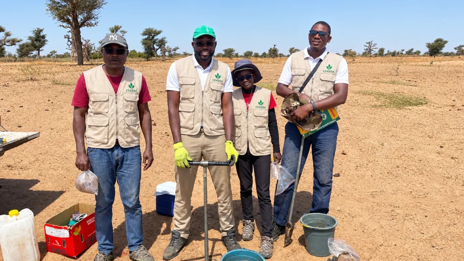
For ISRA, under the Regional Soil Fertility Mapping Programme (project SEN-1049), CEADSA carried out the biophysical characterisation of two reference sites using the LDSF protocol: 320 plots characterised and 96 infiltration tests.
Client / partner: Institut Sénégalais de Recherches Agricoles (ISRA)
- Institutional client: Senegalese Agricultural Research Institute (ISRA)
- Institutional beneficiary: Ministry of Agriculture, Food Sovereignty and Livestock of Senegal
- Programme: Regional Soil Fertility Mapping Programme (RSFMP) – Project SEN-1049
- Methodological framework: Land Degradation Surveillance Framework (LDSF), CIFOR-ICRAF 2025 field manual
- Sites: Ndiarmo (Thiès region) and Sankadji (Sédhiou region, Casamance)
- Period: April – July 2026
- Expertise deployed: agropedology, biophysical land characterisation, soil sampling and standardised environmental data collection
Context and challenges
Soil fertility and ecosystem health are key drivers of agricultural productivity, food security and the resilience of territories to climate change. Assessing them requires reliable, comparable and spatially representative scientific data, which are essential to guide sustainable land management policies and restoration interventions.
With this in mind, CEADSA SARL brought its scientific and technical expertise to the Regional Soil Fertility Mapping Programme (RSFMP), project SEN-1049, through field missions carried out for the Senegalese Agricultural Research Institute (ISRA), on behalf of Senegal’s Ministry of Agriculture, Food Sovereignty and Livestock.
These missions are part of the national biophysical characterisation campaign covering 20 sites in the Sahelian-Sudanian zone. They covered two sites with contrasting biophysical and environmental characteristics: Ndiarmo, in the Thiès region, and Sankadji, in the Sédhiou region of Casamance.
The study helps build the biophysical baseline needed to map soil fertility and soil health, assess land condition and plan restoration interventions at national level.
A standardised methodology based on the LDSF protocol
The work followed the 2025 field manual of the Land Degradation Surveillance Framework (LDSF), developed by CIFOR-ICRAF. This standardised framework assesses soil and ecosystem health at landscape scale through a structured set of observations, measurements and sampling.
The approach combined several complementary modules:
- Biophysical plot characterisation: land cover and land use, vegetation and woody cover, signs of erosion and surface characteristics;
- Soil sampling: composite soil samples at 0–20 cm and 20–50 cm depths;
- Soil physical characterisation: samples for bulk density determination and water infiltration tests;
- Floristic and dendrometric inventories: identification of woody species and measurement of the main characteristics of trees and shrubs;
- Microbiological sampling: soil samples for microbial activity analyses;
- Data collection and digitisation: completion of standardised forms, digital entry with ODK and data transmission as set out in the protocol.
This integrated approach produces harmonised, comparable data on soil properties, vegetation cover and key ecosystem health indicators, to inform decisions on sustainable land management and restoration.
Two reference sites in contrasting environmental settings
Ndiarmo site – Thiès region (10 km × 10 km)
From 7 April to 1 May 2026, operations covered all 16 clusters of the site, i.e. 160 plots.
Sankadji site – Sédhiou region, Casamance (10 km × 10 km)
Work was carried out in two complementary phases: a first campaign covering 12 clusters (120 plots), then a second, from 30 June to 7 July 2026, covering the remaining four clusters (40 plots). This final phase completed coverage of the site, located in and around the Sankadji classified forest.
At both sites, the work covered biophysical plot characterisation, soil sampling at different depths, physical measurements, infiltration tests, floristic and dendrometric inventories and digital data collection. Consultation with local authorities and logistical adaptation to access conditions helped operations run smoothly.
Results and contribution to the national campaign
Mission reports show that 100% of the planned operational indicators were achieved for the documented interventions.
Across the two sites, operations included:
- 320 plots characterised: 160 in Ndiarmo and 160 in Sankadji;
- 96 infiltration tests, 48 at each site;
- soil samples for physico-chemical analyses, bulk density determination and microbiological analyses;
- floristic and dendrometric inventories contributing to ecosystem characterisation;
- collection, digitisation and transmission of field data in line with the LDSF protocol.
Beyond the field operations, this contribution supports a national ambition: building a high-resolution biophysical baseline to better characterise soil fertility and health, identify degradation risks and guide restoration and sustainable land management interventions.
The indicators presented relate to the completion of field work; they do not prejudge subsequent laboratory results or the final mapping conclusions.
CEADSA’s added value
This project demonstrates CEADSA’s ability to deploy scientific and technical expertise for major institutional programmes, rigorously applying standardised international protocols.
It illustrates our know-how in:
- agropedological expertise and soil characterisation;
- implementation of standardised scientific protocols;
- planning and running field campaigns;
- collection, structuring and digitisation of biophysical data;
- technical support for soil fertility mapping and land degradation monitoring programmes.
Through these missions, CEADSA helps strengthen the scientific knowledge needed for more sustainable natural resource management, land restoration and resilient agricultural and agri-food systems in West Africa.